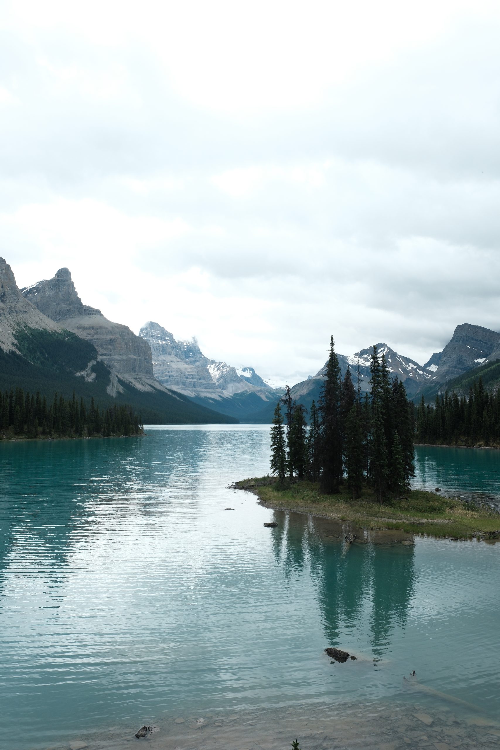
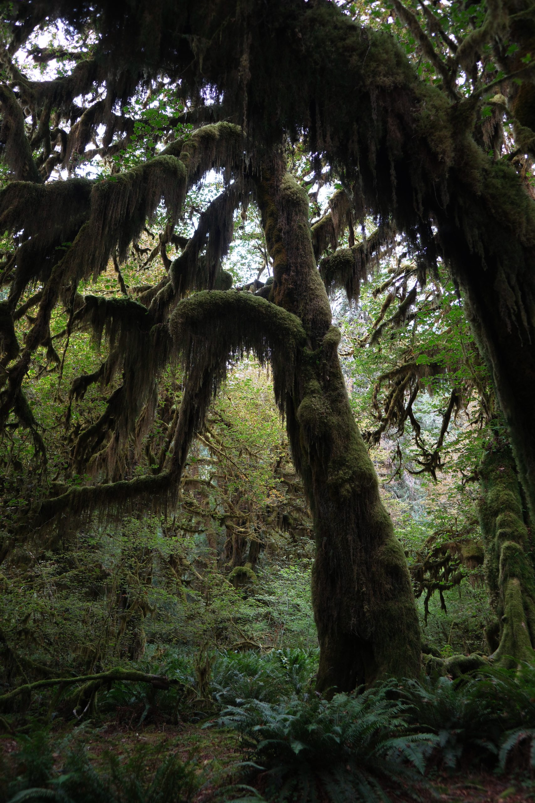
This guide includes our favourite hikes across the Canadian Rockies, including Banff National Park, Kootenay National Park, Peter Lougheed Provincial Park (Kananaskis), Mount Robson Provincial Park and Mount Assiniboine Provincial Park. Every hike on this list is one we’ve completed ourselves, and we’ve considered scenery, overall experience, variety, accessibility and lasting memories (not simply elevation gain or summit bagging).
If you’re planning either a day hiking trip or a longer multi-day backpacking route in the Canadian Rockies and want trails that showcase the very best the region has to offer, this guide is a great place to start.
Check out our other guides:
Hiking in the Canadian Rockies
After hiking hundreds of kilometres across the Canadian Rockies, from gentle lakeside walks to challenging alpine adventures, we’ve put together a list of the hikes we think are truly the best.
These are the trails that have stayed with us long after the hike was over. Our rankings aren’t based on how difficult the hike is or whether it involves scrambling to a summit. Instead, we’ve chosen hikes that deliver unforgettable scenery, spectacular mountain landscapes, peaceful wilderness and the chance to spot wildlife along the way.
If you are looking for an easy day hike in Banff, a challenging alpine trail in Kananaskis, or a multi-day backpacking adventure through some of Canada’s most spectacular national parks, you’ll find something here.
Best time to hike in the Canadian Rockies
The hiking season in the Canadian Rockies is surprisingly short. While some lower-elevation trails may become accessible in late May or June, it really isn’t an exaggeration to say that the best time to hike is limited to July, August and September, when most alpine trails are snow-free and conditions are at their best.
July and August: These are the peak summer months, offering the warmest weather, the longest daylight hours and access to almost every hiking trail. This is the time to see wildflower meadows, turquoise glacial lakes and generally has the most reliable hiking conditions.
September: Cooler temperatures make long days on the trail more comfortable, crowds begin to thin out and the famous golden larch trees transform many alpine valleys into spectacular landscapes. If you’re hoping to experience larch season, aim for the second half of September, although the exact timing varies each year.
Things to consider before hiking in the Canadian Rockies:
Snow:
Snow can linger in the alpine well into July, particularly on north-facing slopes and high mountain passes. This isn’t just the odd patch of snow, some trails can still have deep snowpack, avalanche hazards and sections where you may sink waist-deep into unconsolidated snow.
In June 2026, several hikers required rescue after attempting popular trails around Banff National Park, including the Big Beehive and Little Beehive, because of unexpected snow conditions. Even during July and August, fresh snowfall is possible at higher elevations, while October often marks the return of winter conditions.
Besides the snow, some roads in the rockies don’t even open until mid June to access some areas for hiking.
You can heck recent trail reports and weather forecasts before setting out, but if you are planning a trip to the Canadian Rockies in advance, we’d recommend planning your trip from mid-July.
Wildfire smoke:
Unfortunately, wildfires happen across Canada every summer and even if there isn’t a wildlife burning locally, the smoke can drift in from hundreds of kilometres away. This can affect visibility and more importantly poor air quality can affect your health, especially during long strenuous hikes. If smoke levels are high, it’s usually worth postponing your hike or choosing another day.
Mountain weather:
Weather in the Canadian Rockies can change rapidly. A day that starts with clear blue skies can quickly bring rain, thunderstorms, hail, strong winds or even snow at higher elevations.
Pack extra layers, waterproof clothing and enough food and water, even for shorter hikes. Temperatures can also drop close to freezing overnight or early in the morning, regardless of how warm it becomes during the day.
How we chose the best hikes
Rather than ranking trails by technical difficulty or whether they reach a summit, we’ve focused on:
- Overall scenery and mountain views
- Unique landscapes and natural features
- Wildlife viewing opportunities
- Overall enjoyment and whether we’d happily hike it again
Some of these hikes are challenging, while others are accessible to most reasonably fit hikers. What they all have in common is that they showcase the very best of the Canadian Rockies.
Comparison table of the best hikes in the Canadian Rockies
| Hike | Region | Distance | Time | Difficulty | Best For |
|---|---|---|---|---|---|
| Niblet, Nublet & Cerulean Lake Loop | Mount Assiniboine Provincial Park | 11.1 km | 4–6 hrs | Moderate | Iconic views of Mount Assiniboine, alpine lakes & marmots |
| Lake O’Hara & Lake Oesa via the Alpine Loop Trail | Yoho National Park | 9.5 km | 4–6 hrs | Hard | Exclusive access, alpine lakes, wildflowers & iconic Lake O’Hara views |
| Stanley Glacier Trail | Kootenay National Park | 13 km | 4–5 hrs | Moderate–Hard | Glacier scenery, waterfalls, fossils & wildlife |
| Rockwall Trail | Kootenay National Park | 54–55 km | 3–5 days | Hard | Canada’s premier backpacking route with glaciers, alpine passes & Floe Lake |
| King Creek Ridge | Peter Lougheed Provincial Park (Kananaskis) | 7.4 km | 3–5 hrs | Hard | Spectacular ridge walk with panoramic mountain views |
| Berg Lake Trail | Mount Robson Provincial Park | 40.1 km | 10 hrs or 2-4 days | Hard | Lush temperate rainforest, turquoise lakes, powerful waterfalls, alpine meadows and dramatic glacier-covered landscapes. |
Best hikes in the Canadian Rockies
Niblet, Nublet and Nub Peak, Cerulean Lake, Sunburst Lake Loop Trail (Mount Assiniboine Provincial Park)
Distance: 11.1km (approximately 9km if you skip Nub Peak)
Elevation gain: 679m (less if you skip Nub Peak)
Difficulty: Rated as hard on All Trails; we’d describe it as a moderate hike.
Why it’s one of the best hikes:
- Insane views of Mount Assiniboine, Sunburst Mountain and the surrounding lakes
- Marmots everywhere on the Nublet
- Pristine Cerulean Lake is perfect for a dip; one of the most beautiful lakes in the Canadian Rockies
Things to know: This is a day hike, but first you have to get to Assiniboine Provincial Park which requires a helicopter in or approximately a 26 km hike in (best done over 2 days).
Overview:
If you’re fortunate enough to secure a campsite, lodge or hut reservation in Mount Assiniboine Provincial Park, you’re in for one of the finest hiking experiences in the Canadian Rockies. Lets just say that Assiniboine is truly a special place. It feels untouched and in some ways it is, with access only on foot or by a helicopter. The absence of road access keeps visitor numbers low, creating a rare sense of wilderness that’s increasingly difficult to find.
The mountains are spectacular. The lakes are pristine. The glaciers are magnificent. The wildlife is abundant. All these things combine to make the perfect Canadian Rockies landscape. It’s honestly like stepping into one of those old oil paintings of North American mountains and lakes with a bald eagle flying through the sky. There’s no other way to describe it, except for perfect.
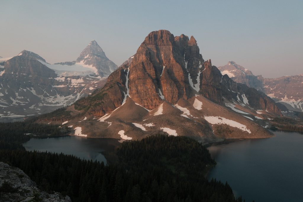
If we could recommend just one hike in Mount Assiniboine Provincial Park, this would be it. Views, views, views. The views begin almost immediately and only improve as you gain elevation. Looking across to Mount Assiniboine with Sunburst and Cerulean Lakes below is one of the most iconic panoramas in the Canadian Rockies and arguably one of the best mountain views in Canada.
Although the trail is rated hard on AllTrails, we found it more moderate than difficult. The climb is steady rather than steep, with a few loose rocky sections and short stretches of scree, but nothing particularly technical.
One of our favourite parts of the hike is the colony of marmots that live around the Nublet. They’re found sunbathing on the rocks and seemingly also enjoying the view.
Cerulean Lake is another highlight and probably the most perfect lake we’ve seen in Canada. Its crystal-clear turquoise water, shallow shoreline and peaceful setting beneath Sunburst Mountain make it an ideal place to stop for lunch, relax or even take a refreshing swim on a warm summer day.
If you can. we’d recommend hiking at sunrise or sunset when the light on Mount Assiniboine is at its best.
While many hikers continue to Nub Peak, you can turn around at the Nublet. The higher you climb, the more you lose the classic perspective of Sunburst and Cerulean Lakes sitting beneath Mount Assiniboine, which we think is the defining view of this hike.
Lake O’Hara and Lake Oesa via Alpine Loop Trail (Yoho National Park)
Distance: 9.5 km
Elevation gain: 465 km
Difficulty: Hard. The trail includes steep sections, uneven terrain and a scree slope that requires careful footing.
Why it’s one of the best hikes:
- Some of the most spectacular alpine scenery in the Canadian Rockies
- A wonderful mix of turquoise lakes, alpine meadows and dramatic peaks
- One of the most exclusive hiking areas in Canada due to limited visitor numbers
- Excellent opportunities to spot wildlife, including marmots, pikas, bears and even the occasional wolverine
- Home to some of the bluest alpine lakes you’ll find anywhere in the Canadian Rockies
Things to know:
Access permits: Lake O’Hara is one of the most sought-after hiking destinations in the Canadian Rockies. The 11 km access road is closed to public vehicles, so there are only three ways to reach the lake:
- Reserve a seat on the Parks Canada shuttle bus (spaces are extremely limited).
- Secure a campsite at Lake O’Hara Campground, which includes shuttle access.
- Stay at Lake O’Hara Lodge, although reservations are difficult to obtain and often booked well in advance.
Walking the access road: If you can’t secure a shuttle or camping reservation, you can still hike the 11 km access road to Lake O’Hara. However, this adds an extra 22 km return to your day, turning this route into a very long and demanding hike.
Overview:
Much like Mount Assiniboine, Lake O’Hara is one of those rare places that feels genuinely special. Limited visitor numbers mean the trails never feel overcrowded, allowing you to experience one of the most beautiful corners of Yoho National Park in relative peace.
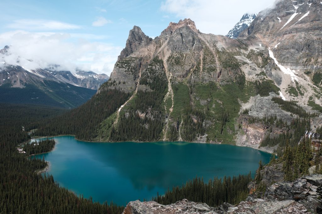
This route begins by climbing the famous Opabin Alpine Circuit, where you’re rewarded with breathtaking views looking down over the deep-blue waters of Lake O’Hara, framed by rugged peaks and towering cliffs. It’s one of the most iconic viewpoints in the Canadian Rockies and worth the visit for this view alone.
From there, the trail winds through colourful alpine meadows that burst into life with wildflowers during the summer months before climbing towards Lake Oesa. Along the way, you’ll pass several impossibly turquoise alpine lakes, cross a scree slope where pikas dart between the rocks and have excellent chances of spotting marmots grazing nearby. Wildlife is abundant throughout the area, and while much rarer, bears and even wolverines are occasionally seen.
Lake Oesa is another unforgettable highlight. Surrounded by towering mountains and fed by glacial meltwater, its vivid turquoise colour almost looks unreal on a sunny day. Combined with the succession of stunning viewpoints and remarkably varied landscapes, it’s a hike that keeps getting better from start to finish.
For us, Lake O’Hara is one of the most magical places in the Canadian Rockies. The combination of restricted access, exceptional scenery and peaceful trails creates an experience that feels genuinely different from anywhere else in the Rockies, making this one of the most memorable day hikes we’ve ever done.
Stanley Glacier Trail (Kootenay National Park)
Distance: 13 km (All Trails will tell you it’s shorter, but it’s wrong)
Elevation gain: 607 m
Difficulty: Rated as hard on All Trails; we would describe it as a moderately challenging hike. The climb is steady but never particularly technical, although there is a steep loose rock section as you head up/down to the glacier.
Why it’s one of the best hikes:
- Spectacular alpine scenery once you emerge from the forest, with impressive views of Stanley Glacier and the surrounding peaks
- A relatively accessible day hike with a huge scenic payoff
- Excellent opportunities to spot wildlife, including marmots, pikas and, if you’re incredibly lucky like we were, even a lynx
- One of the best hikes in the Canadian Rockies for seeing ancient marine fossils
- Seasonal waterfalls cascade down the surrounding cliffs in early summer
Things to know:
- Proximity to Banff National Park: The trail head lies just a few minutes from Banff National Park, making it an easy day trip from Banff.
- Parking: The car park fills up quickly during summer, especially on weekends. We’d recommend arriving before 9:00 am or after around 2:00 pm for a better chance of finding a space and enjoying a quieter trail.
- Hiking poles: We recommend bringing hiking poles to navigate the loose rock coming down from the glacier.
Overview:
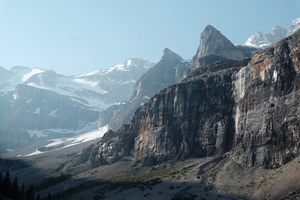
The Stanley Glacier Trail is one of Kootenay National Park’s best day hikes we’ve been on and offers an excellent reward for relatively modest effort.
The first couple of kilometres wind steadily through the forest, but after around 2.5 km the landscape opens dramatically into a broad glacial valley. From here, the views become increasingly impressive, with towering cliffs, rugged mountain peaks and Stanley Glacier dominating the horizon. It’s the point where this hike truly comes to life.
If you’re visiting in early summer, or shortly after heavy rain, the surrounding cliffs come alive with countless waterfalls fed by melting snow and ice. Combined with the glacier and dramatic mountain scenery, it creates one of the most beautiful landscapes in Kootenay National Park.
Wildlife sightings are another reason we love this trail. Marmots and pikas are common around the upper valley, and we were fortunate enough to spot a lynx near the trailhead.
Despite being in Kootenay National Park, the trail sits just a few minutes beyond the Banff National Park boundary, making it an easy day trip from Banff. That convenience also makes it one of the park’s most popular hikes, and tour groups often visit during the middle of the day.
To experience the trail at its best, we’d recommend starting early or hiking later in the afternoon. We set off at 7:30 am in July and had the trail entirely to ourselves until we were making our way back down, making an already beautiful hike feel even more special.
Rockwall Trail (Kootenay National Park)
Distance: 54–55 km (multi-day backpacking trail)
Elevation gain: Approximately 3,400 m (travelling north to south, Paint Pots to Floe Lake)
Difficulty: Challenging. While the trail isn’t technically difficult, the distance, cumulative elevation gain and several river crossings make this a demanding backpacking trip.
Why it’s one of the best hikes:
- One of the best multi-day backpacking trips in the Canadian Rockies
- Incredible variety of scenery, including the towering Rockwall escarpment, hanging glaciers, alpine passes, wildflower meadows, waterfalls and turquoise lakes
- A true wilderness experience with long stretches far from roads and crowds
- Visits Floe Lake, one of the most beautiful alpine lakes in the Canadian Rockies
- Includes a section of the iconic Great Divide Trail (GDT)
Things to know:
- Time: Most hikers complete the Rockwall Trail in 3–5 days, although experienced trail runners and very strong hikers sometimes tackle sections as long day hikes.
- Trailheads: The most common route starts at the Paint Pots Trailhead on Highway 93 South and finishes at the Floe Lake Trailhead. Alternative access points are available via Numa Creek and Tumbling Creek.
- Permit: A backcountry camping permit is required for overnight trips between July and September. Campers must carry a copy of their permit (either printed or downloaded to their phone). We’ve covered the booking process and everything you need to know about permits later in this guide.
Overview:
The Rockwall Trail is widely regarded as one of the finest backpacking routes in the Canadian Rockies, and after hiking it ourselves, it’s easy to see why.
Stretching through the heart of Kootenay National Park, the trail follows the base of the spectacular Rockwall – a towering limestone escarpment that rises more than 900 metres (2,950 ft) above the valley floor in places. It’s one of the most dramatic mountain landscapes in the Rockies and gives the trail its name.
What makes the Rockwall Trail so memorable is the sheer variety of scenery. Over the course of a few days, you’ll cross high alpine passes, walk beneath hanging glaciers, pass roaring waterfalls, wander through colourful wildflower meadows and camp beside crystal-clear alpine lakes. Every day feels completely different from the last, making this one of the most rewarding backpacking trips in Canada.
Despite its popularity, the Rockwall still feels wonderfully remote. Once you’re away from the trailheads, there are long stretches where the only sounds are rushing rivers, waterfalls and the occasional whistle of a marmot. If you’re looking for a true backcountry experience without needing technical mountaineering skills, this is one of the best options in the Canadian Rockies.
The final highlight for many hikers is Floe Lake. Set beneath towering cliffs and backed by rugged mountain peaks, it’s one of the most beautiful alpine lakes in the Canadian Rockies and an unforgettable place to spend a night or celebrate the end of the hike. Along the way, you’ll also follow part of the famous Great Divide Trail, adding another iconic experience to an already exceptional backpacking adventure.

King Creek Ridge (Peter Lougheed Provincial Park, Kananaskis)
Distance: 7.4 km
Elevation gain: 785 m
Difficulty: Hard. The hike is physically demanding due to the steep ascent and loose rock, but it doesn’t involve technical scrambling.
Why it’s one of the best hikes:
- Some of the most unique mountain scenery in the Canadian Rockies
- Spectacular 360-degree views across Peter Lougheed Provincial Park
- A relatively short hike with an enormous scenic reward
- One of the best ridge walks in Kananaskis (that feels safe)
Things to know:
- Parking: The trailhead car park is small and fills up quickly during summer, particularly on weekends. We’d recommend arriving early in the morning to secure a parking space.
- Hiking poles: Bring hiking poles if you have them – you’ll need them for the way down.
Overview:
King Creek Ridge is one of those hikes that makes you stop in your tracks the moment the landscape opens up.
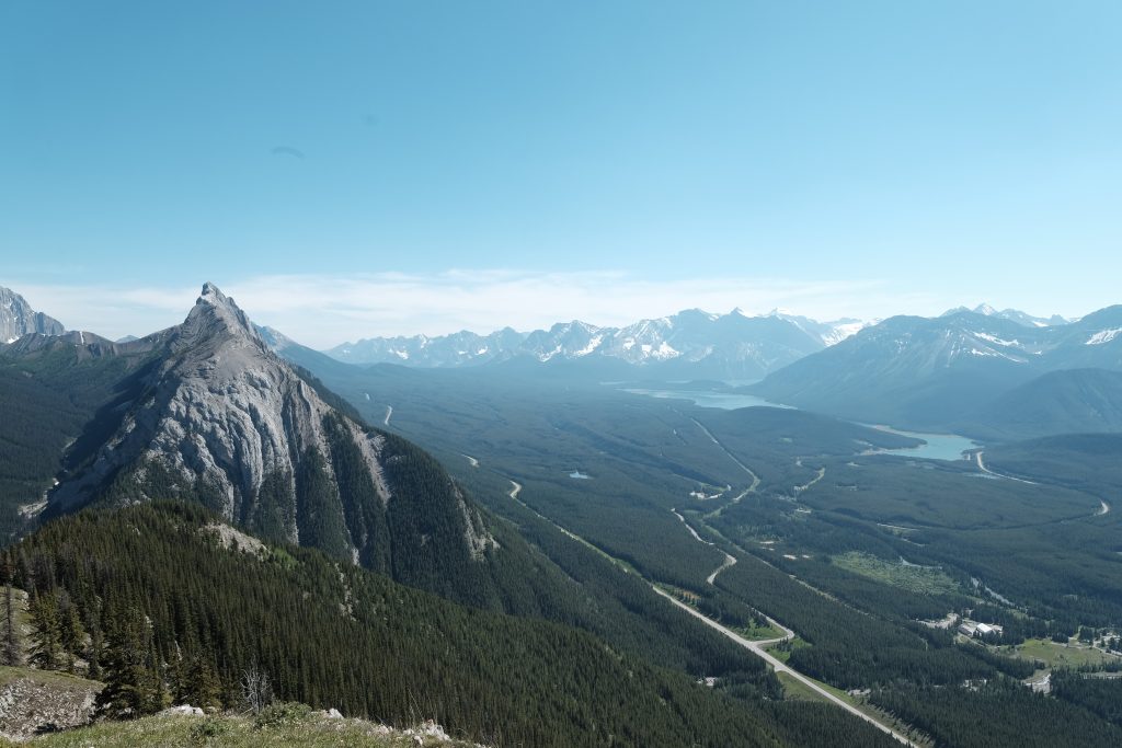
After a steep climb through the forest, the trees suddenly give way to a panorama of alpine meadows, jagged limestone peaks and deep valleys. It’s a landscape that feels surprisingly different from much of the Canadian Rockies. In fact, it reminded us more of the European Alps, where vibrant green slopes rise towards dramatic rocky summits.
The views continue to improve as you reach the ridge. From here, you’ll enjoy uninterrupted 360-degree panoramas across Peter Lougheed Provincial Park, including Upper and Lower Kananaskis Lakes, Fortress Mountain and countless surrounding peaks stretching across the horizon. It’s one of the best viewpoints we’ve found anywhere in Kananaskis.
You’ll have to earn those views. The climb to the ridge is steep and follows loose, rocky terrain that can be slippery underfoot. Fortunately, much of the ascent remains within the trees, so although it’s physically demanding, it never feels especially exposed.
Once on the ridge, the hard work is over. A beautiful ridgeline trail leads towards the summit, passing several outstanding viewpoints along the way. Many hikers stop at the false summit, where the panoramic views are already exceptional, but we’d strongly recommend continuing to the very end of the ridge. The additional effort is minimal, and you’ll be rewarded with even more impressive views into a different part of the valley that many people miss.
For us, King Creek Ridge is one of the standout hikes in Kananaskis. It packs an incredible amount of scenery into a relatively short distance, and the combination of alpine meadows, dramatic limestone peaks and sweeping ridge-top views makes it unlike almost any other hike in the Canadian Rockies.
Berg Lake Trail (Mount Robson Provincial Park)
Distance: 40.1 km
Elevation gain: 1,546 m
Difficulty: Hard. Although the trail is well maintained and easy to follow, it’s a long hike with significant elevation gain. Most hikers complete it as an overnight backpacking trip.
Why it’s one of the best hikes:
- A spectacular journey through lush temperate rainforest (unique to the Canadian Rockies), turquoise lakes, powerful waterfalls, alpine meadows and dramatic glacier-covered landscapes.
- Circles the flanks of Mount Robson (3,954 m), the highest peak in the Canadian Rockies.
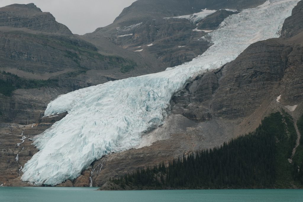
- Finishes at Berg Lake, where the impressive Berg Glacier tumbles down the mountainside and regularly calves into the vivid turquoise water below.
Things to know:
- Although some experienced hikers complete the Berg Lake Trail in a single day, it’s best enjoyed over two or three days. Several backcountry campgrounds are located along the route, including Berg Lake Campground, and reservations are required well in advance due to high demand.
Overview:
The Berg Lake Trail is widely regarded as one of the best hikes in Canada and one of the most iconic backpacking trips in the Canadian Rockies. Demand is so high that backcountry camping reservations often sell out within hours of opening each winter for the following hiking season.
The first 5 km follows a relatively gentle trail through lush temperate rainforest to Kinney Lake, a section that’s also popular with day hikers. Unlike much of the Canadian Rockies, the dense forest here has a distinctly coastal British Columbia feel, with towering cedars, hemlocks and vibrant moss-covered vegetation.
Beyond Kinney Lake, the trail climbs steadily through the aptly named Valley of a Thousand Falls, where countless waterfalls cascade from the surrounding glaciers and icefields. One of the highlights is the thunderous Emperor Falls, whose mist provides a welcome break on a warm summer day.
As the trail continues around the northern slopes of Mount Robson, the scenery becomes increasingly alpine. Wildflower meadows give way to sweeping views of glaciers before the spectacular Berg Glacier finally comes into view. The trail ends at Berg Lake Campground, where you can relax beside the brilliant turquoise lake and take in one of the most unforgettable mountain landscapes in the Canadian Rockies.
If you have any questions about planning this trip, feel free to drop a comment below. We’d love to help you craft the perfect itinerary. Please note that some links on this page are affiliate links. If you choose to purchase through these links, we may receive a small commission at no cost to you. This helps us to keep the site running. Thanks!